Stephanie Oliver's Artwork
Menu
Stephanie Oliver
cartography
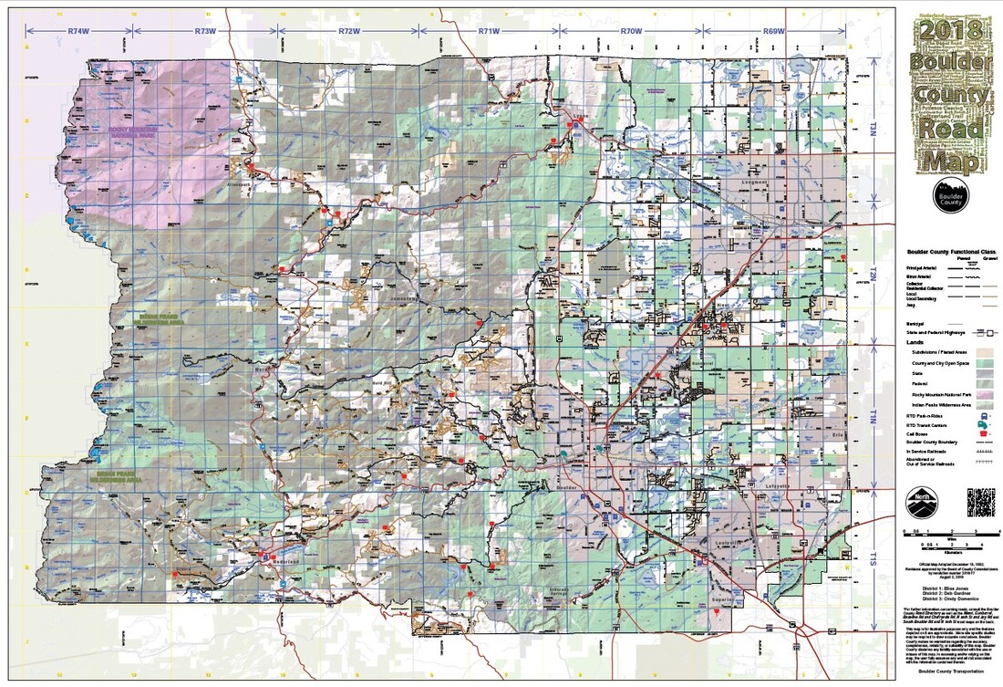
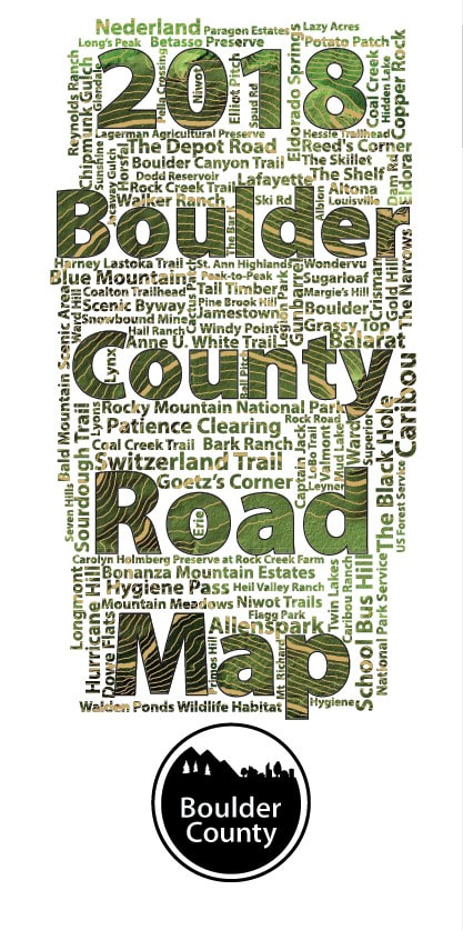
2018 Boulder County Road Map
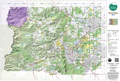
2013 Boulder County Road Map
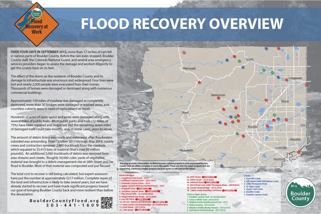
Flood Recovery Sign (4ft x 6ft)
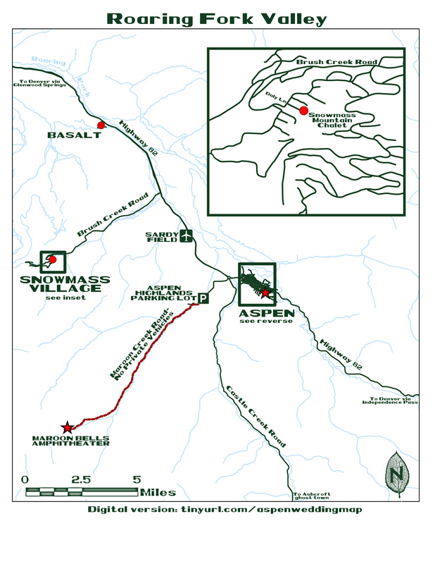
Map of Roaring Fork Valley, near Aspen, CO for Wedding insert
Map of Aspen, CO for Wedding insert
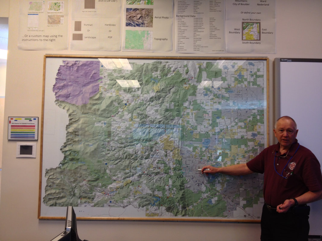
5ft x 7ft Wall map for the Emergency Operations Center
Newspaper advertisement for N. 95th St. construction closure
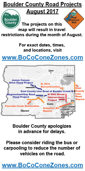
Digital advertisement for construction projects in Boulder County
Vector graphic of Scenic Byway sign
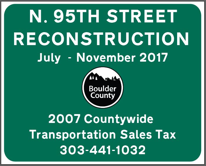
Road sign for N. 95th St project
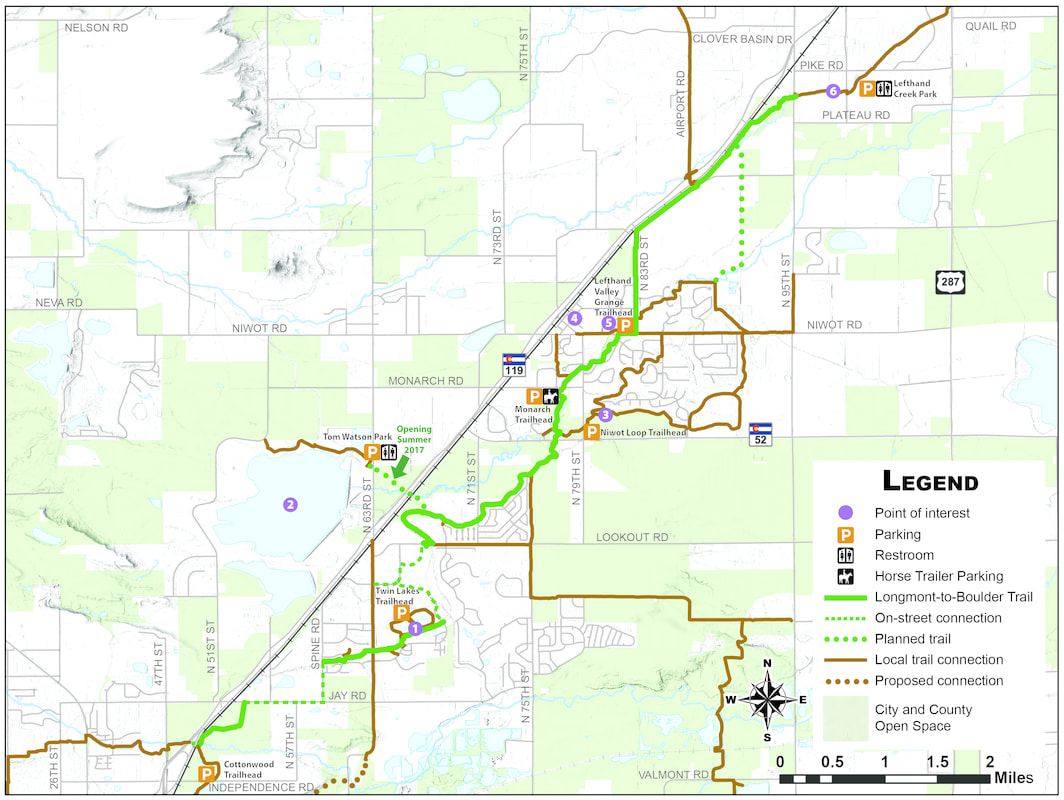
Longmont-to-Boulder Regional Trails Map
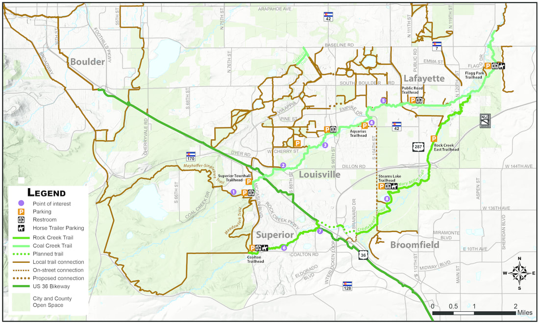
Rock Creek / Coal Creek Regional Trails Map
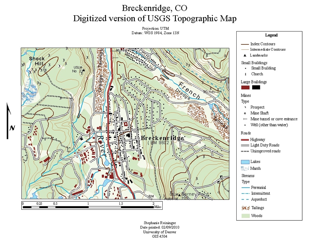
Fully digitized version of part of a USGS quad map, assignment while completing GIS program at the University of Denver
Scientific Illustration
Cartography
Photography & Digital Artwork
Contact
Scientific Illustration
Cartography
Photography & Digital Artwork
Contact